Toggle navigation
GOVPH
Home
Weather
General Weather
Daily Weather Forecast
Weather Outlook Selected Philippine Cities
Asian Cities Weather Forecast
Weather Outlook Selected Tourist Areas
Weekly Weather Outlook
Weather Advisory
Aviation
SIGMET
METAR
Terminal Aerodome Forecast
Airways and Terminal Forecast
Marine
High Seas and Offshore Waters Forecast
Gale Warning
Heat Index
Daily Temperature
Flood
Flood Information
Dam Information
Projects
Tropical Cyclone
Tropical Cyclone Advisory
Tropical Cyclone Bulletin
Tropical Cyclone Warning for Shipping
-->
Forecast Storm Surge
Tropical Cyclone Warning for Agriculture
TC-Threat Potential Forecast
Tropical Cyclone Associated Rainfall
Tropical Cyclone Publications
Annual Report on Philippine Tropical Cyclones
Tropical Cyclone Preliminary Report
About Tropical Cyclone
Climate
Climate Monitoring
Daily Rainfall and Temperature
Monthly Monitoring Products
Southeast Asia Climate Monitoring
Climate Forum
Climate Prediction
10 Day Climate Forecast
Sub Seasonal
Seasonal Forecast
Specialized Forecast
Climate Advisories
El Niño / La Niña
Monitoring
Advisories
Climate Projection
Dynamic Downscaling
CliMap
Statistical Downscaling
Climate Data
Agri-Weather
Climate Information for Agriculture
Farm Weather Forecast
Weekend/Special Farm Weather Forecast
Ten-Day Regional Agri-Weather Information
Monthly Philippine Agro-Climatic Review and Outlook
Impact Assessment for Agriculture
Astronomy
Telescoping and Stargazing
Astronomy in the Philippines
Planetarium
Astronomical Observatory
Time Service
Philippine Standard Time
Astronomical Diary
Regional Forecast
Northern Luzon
National Capital Region
Southern Luzon
Visayas
Mindanao
Products and Services
Engineering Services
Calibration Services
Numerical Prediction Model
Satellites
Flood Monitoring for Metro Manila
Risk Analysis Map
Flood Hazard Map
Regional Severe Wind Hazard Maps
High Frequency Doppler Radar
Vacancy
GAD Corner
Learnings
Publication
FAQs and Trivias
Learning Tools
Research and Development
Information
Rainfall and Thunderstorm Warning System
Weather Terminologies
Flood Forecasting and Warning System for River Basins
Climate of the Philippines
Climate Change in the Philippines
Astronomy in the Philippines
Field Station Categories
Basic Cloud Seeding Operations
Storm Surge Information
Legend
About Us
Contact Us
National Meteorological and Hydrological Services
Related Linkages
Transparency Seal
About Us
Mandate and Functions
PAGASA Key Officials
Annual Reports
Accomplishment Reports
Annual Procurement Plan
Approved Budget and Corresponding Targets
Major Programs and Projects
Status of Implementations of Program/Projects
Program/Projects Beneficiaries
Products and Services
Privacy Notice
Accessibility
Contact Us
Weather
General Weather
Daily Weather Forecast
Weather Outlook Selected Philippine Cities
Asian Cities Weather Forecast
Weather Outlook Selected Tourist Areas
Weekly Weather Outlook
Weather Advisory
Aviation
SIGMET
METAR
Terminal Aerodome Forecast
Airways and Terminal Forecast
Marine
High Seas and Offshore Waters Forecast
Gale Warning
Heat Index
Daily Temperature
Flood
Flood Information
Dam Information
Projects
Tropical Cyclone
Tropical Cyclone Advisory
Tropical Cyclone Bulletin
Tropical Cyclone Warning for Shipping
Forecast Storm Surge
Tropical Cyclone Warning for Agriculture
TC-Threat Potential Forecast
Tropical Cyclone Associated Rainfall
Tropical Cyclone Publications
Annual Report on Philippine Tropical Cyclones
Tropical Cyclone Preliminary Report
About Tropical Cyclone
Climate
Climate Monitoring
Daily Rainfall and Temperature
Monthly Monitoring Products
Southeast Asia Climate Monitoring
Climate Forum
Climate Prediction
10 Day Climate Forecast
Sub Seasonal
Seasonal Forecast
Specialized Forecast
Climate Advisories
El Niño / La Niña
Monitoring
Advisories
Climate Projection
Dynamic Downscaling
CliMap
CliMap v2.0
Statistical Downscaling
Climate Data
Agri-Weather
Climate Information for Agriculture
Farm Weather Forecast
Weekend/Special Farm Weather Forecast
Ten-Day Regional Agri-Weather Information
Monthly Philippine Agro-Climatic Review and Outlook
Impact Assessment for Agriculture
Astronomy
Telescoping and Stargazing
Astronomy in the Philippines
Planetarium
Astronomical Observatory
Time Service
Philippine Standard Time
Astronomical Diary
Regional Forecast
Northern Luzon
National Capital Region
Southern Luzon
Visayas
Mindanao
Products and Services
Engineering Services
Calibration Services
Numerical Prediction Model
Satellites
Flood Monitoring for Metro Manila
Risk Analysis Map
Flood Hazard Map
Regional Severe Wind Hazard Maps
High Frequency Doppler Radar
Vacancy
GAD Corner
Learnings
Publication
FAQs and Trivias
Learning Tools
Research and Development
Information
Rainfall and Thunderstorm Warning System
Weather Terminologies
Flood Forecasting and Warning System for River Basins
Climate of the Philippines
Climate Change in the Philippines
Astronomy in the Philippines
Field Station Categories
Basic Cloud Seeding Operations
Storm Surge Information
Legend
About Us
Contact Us
National Meteorological and Hydrological Services
Related Linkages
Department of Science and Technology
Philippine Atmospheric, Geophysical and
Astronomical Services Administration
Philippine Standard Time
06:54:35 AM
7 July 2025
Weather
General Weather
Daily Weather Forecast
Weather Outlook Selected Philippine Cities
Asian Cities Weather Forecast
Weather Outlook Selected Tourist Areas
Weekly Weather Outlook
Weather Advisory
Aviation
SIGMET
METAR
Terminal Aerodome Forecast
Airways and Terminal Forecast
Marine
High Seas and Offshore Waters Forecast
Gale Warning
Heat Index
Daily Temperature
Flood
Flood Information
Dam Information
Projects
Tropical Cyclone
Tropical Cyclone Advisory
Active
Tropical Cyclone Bulletin
Active
Tropical Cyclone Warning for Shipping
Active
Forecast Storm Surge
Tropical Cyclone Warning for Agriculture
Active
TC-Threat Potential Forecast
Tropical Cyclone Associated Rainfall
Tropical Cyclone Publications
Annual Report on Philippine Tropical Cyclones
Tropical Cyclone Preliminary Report
About Tropical Cyclone
Climate
Climate Monitoring
Daily Rainfall and Temperature
Monthly Monitoring Products
Southeast Asia Climate Monitoring
Climate Forum
Climate Prediction
10 Day Climate Forecast
Sub Seasonal
Seasonal Forecast
Specialized Forecast
Climate Advisories
El Niño / La Niña
Monitoring
Advisories
Climate Projection
Dynamic Downscaling
CliMap
CliMap v2.0
Statistical Downscaling
Climate Data
Agri-Weather
Climate Information for Agriculture
Farm Weather Forecast
Weekend/Special Farm Weather Forecast
Ten-Day Regional Agri-Weather Information
Monthly Philippine Agro-Climatic Review and Outlook
Impact Assessment for Agriculture
Astronomy
Telescoping and Stargazing
Astronomy in the Philippines
Planetarium
Astronomical Observatory
Time Service
Philippine Standard Time
Astronomical Diary
Regional Forecast
Northern Luzon
National Capital Region
Southern Luzon
Visayas
Mindanao
Visayas
Cebu
Bohol
Negros Occidental
Negros Oriental
Siquijor
Leyte
Southern Leyte
Biliran
Samar
Eastern Samar
Iloilo
Guimaras
Capiz
Aklan
Antique
Palawan
Occidental Mindoro
Regional Forecast
Issued At: 05:00 AM, 7 July, 2025
Partly cloudy skies to at times cloudy with rainshowers or thunderstorm
25°
32°
Wind Speed:
Light to Moderate
Direction:
Southwest to South
Coastal Condition:
Slight to Moderate
Partly cloudy skies to at times cloudy with rainshowers or thunderstorm
25°
30°
Wind Speed:
Light to Moderate
Direction:
Southwest to South
Coastal Condition:
Slight to Moderate
Extended Weather Outlook
Issued at: 09:00 AM, 6 July, 2025
Sunday
25°
32°
Wind Speed
Light to Moderate
Direction
Southwest to South
Coastal Condition
Slight to Moderate
Monday
25°
32°
Wind Speed
Light to Moderate
Direction
Southwest
Coastal Condition
Slight to Moderate
Tuesday
25°
32°
Wind Speed
Light to Moderate
Direction
Southwest
Coastal Condition
Slight to Moderate
Wednesday
25°
32°
Wind Speed
Light to Moderate
Direction
Northwest to Southwest
Coastal Condition
Slight to Moderate
Thursday
25°
32°
Wind Speed
Light to Moderate
Direction
Southwest
Coastal Condition
Slight to Moderate
Rainfall Warning
Thunderstorm Warning
1
Special Forecasts
3
As of today, there is no Heavy Rainfall Warning Issued.
Thunderstorm Watch #VISPRSD
Issued at 10:00 PM 06 July 2025
Thunderstorm is MORE LIKELY to develop over #Palawan and #OccidentalMindoro within 12 hours.
Mt. Kanlaon
Issued at: 05:00 AM, 7 July, 2025
Valid until: 05:00 AM, 8 July, 2025
SWF for 58th Charter Day of Cadiz City
Issued at: 05:00 AM, 7 July, 2025
Valid until: 05:00 AM, 8 July, 2025
SWF FRLD LLC
Issued at: 05:00 AM, 7 July, 2025
Valid until: 05:00 AM, 8 July, 2025
Greater Metro Manila Area Forecast
Radar Layers
Radar Mosaic
Satellite Layers
HIMAWARI IR1
Latest Weather
Temperature (°C)
Heat Index (°C)
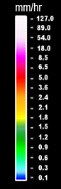
Precipitation (mm/hr)
Winds
Contours
Temperature
Rain Fall (1hr Cumulative Data)
Alerts
Active Warnings
Lightning
Domain
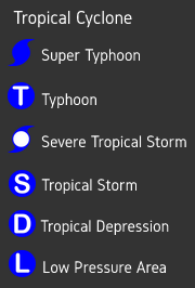
Tropical Cyclone Advisory
Tropical Cyclone Information
Weather Monitoring Tool
Hazard Map
Satellite
Himawari IR1
GK2A
SatREx
Radar
Surface Map Analysis
Numerical Weather Prediction
Active Warnings
Show Legend
General Flood Advisory
Tropical Cyclone Alert